Boston-Mills Fact Sheet
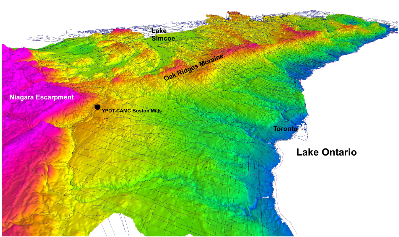 Figure 1: Location of Boston-Mills
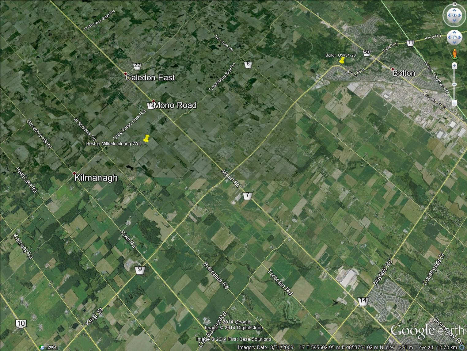 Figure 2: Aerial photo of Boston-Mills
Background
A borehole was drilled and a well installed at this location in 2006 as part of investigations studying buried bedrock valley aquifer systems in southern Ontario (Figure 1; Davies et al., 2008). Seismic geophysical surveys helped to situate this well close to the thalweg of the Caledon East buried bedrock valley. The Caledon East buried bedrock valley which is believed to be a tributary or re-entrant channel trending roughly west-east into the main Laurentian bedrock valley system situated between Georgian Bay and Lake Ontario (Figure 2 and Figure 3). Details regarding the sediment stratigraphy within the main Laurentian and tributary valleys and groundwater movement within these features remain sketchy despite the valley having been known for over 100 years (Spencer, 1881; 1890).
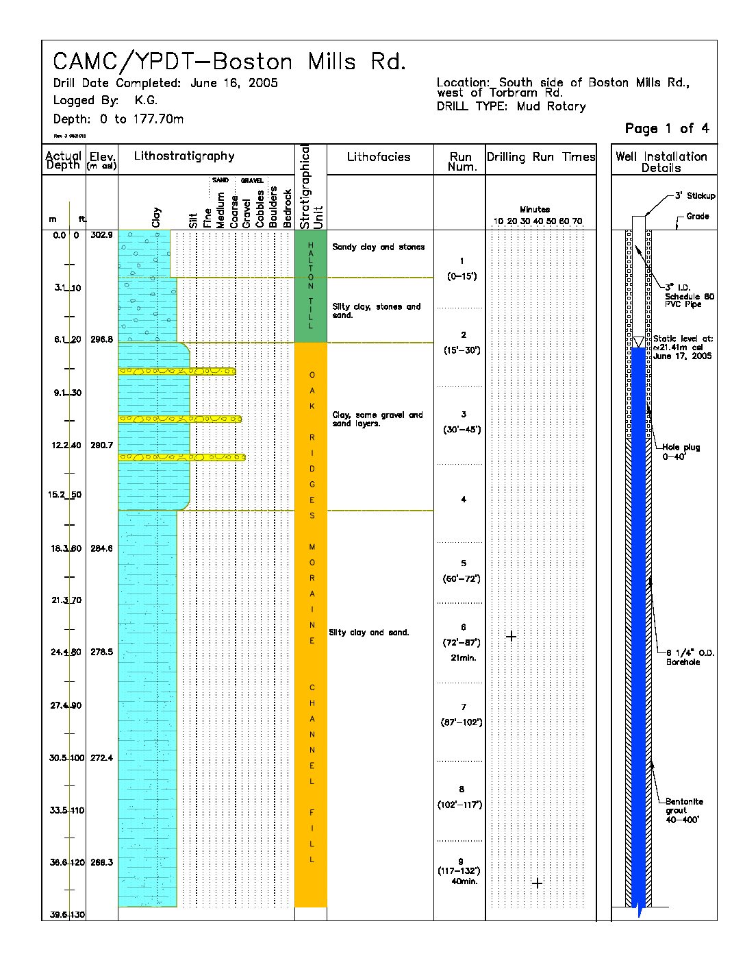
The Boston Mills monitoring well is screened within a 20m thick sand and gravel unit (150 to 171 mbgs) situated above shale bedrock. The interpreted thickness and extent of this basal aquifer (shown as the Scarborough aquifer complex) is illustrated on Figure 5 and Figure 6.
Documents
YPDT-CAMC Boston Mills borehole log Download pdf
Davies, S.D., S. Holysh and D.R. Sharpe. 2008. An investigation of the buried bedrock valley aquifer system in the Caledon East area, Southern Ontario. Ontario Geological Survey, Groundwater Resources Study 9, 42p. Download pdf
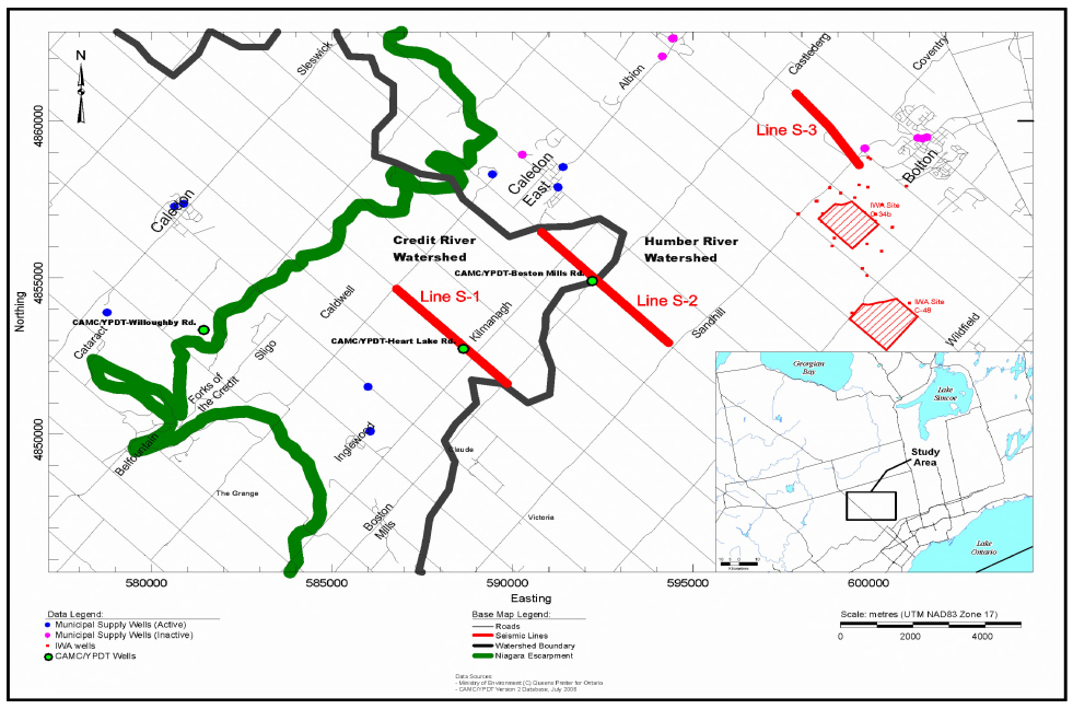 Figure 3: Boston-Mills borehole location
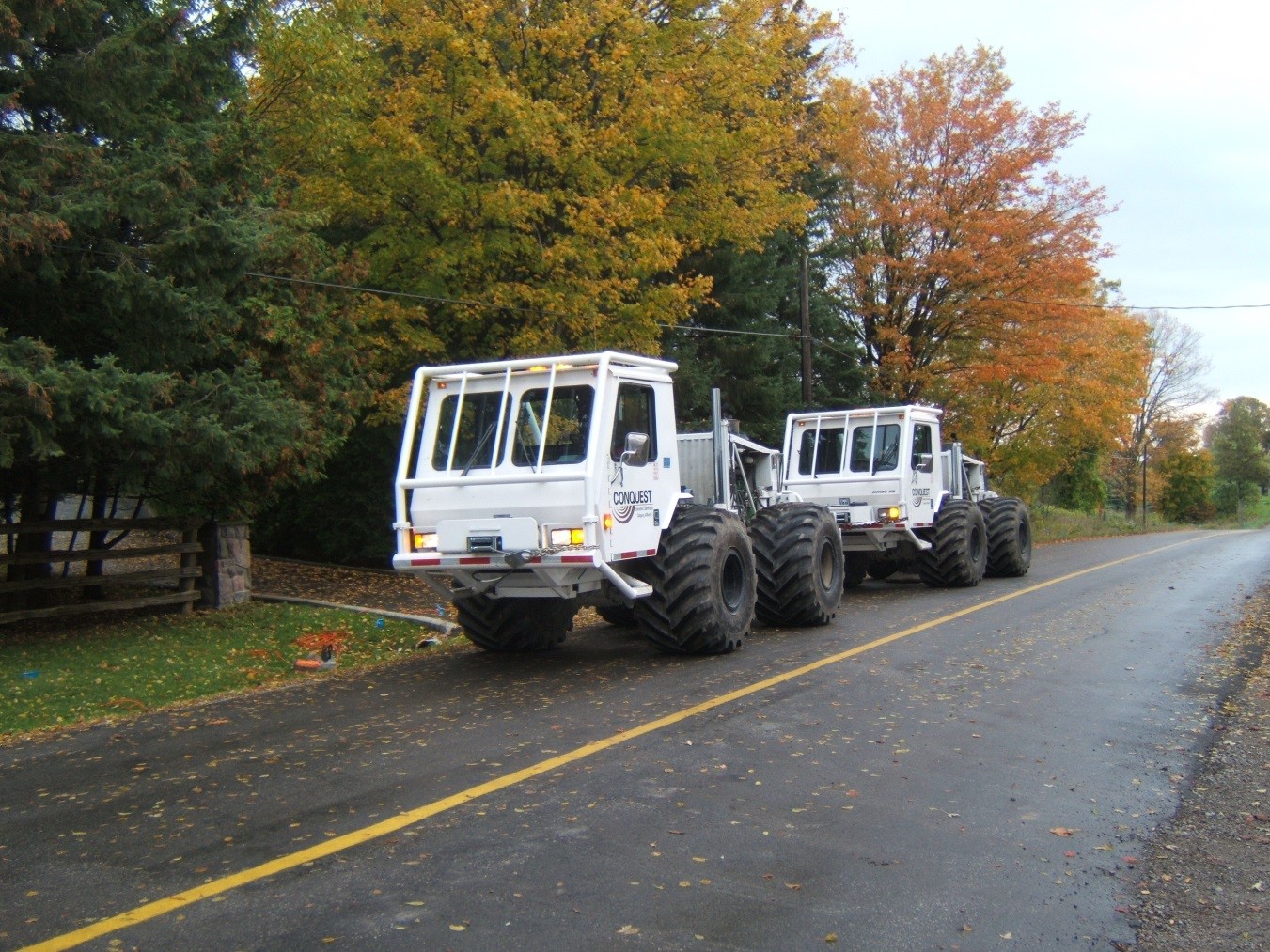 Figure 4: Seismic reflection survey being conducted along Airport Road
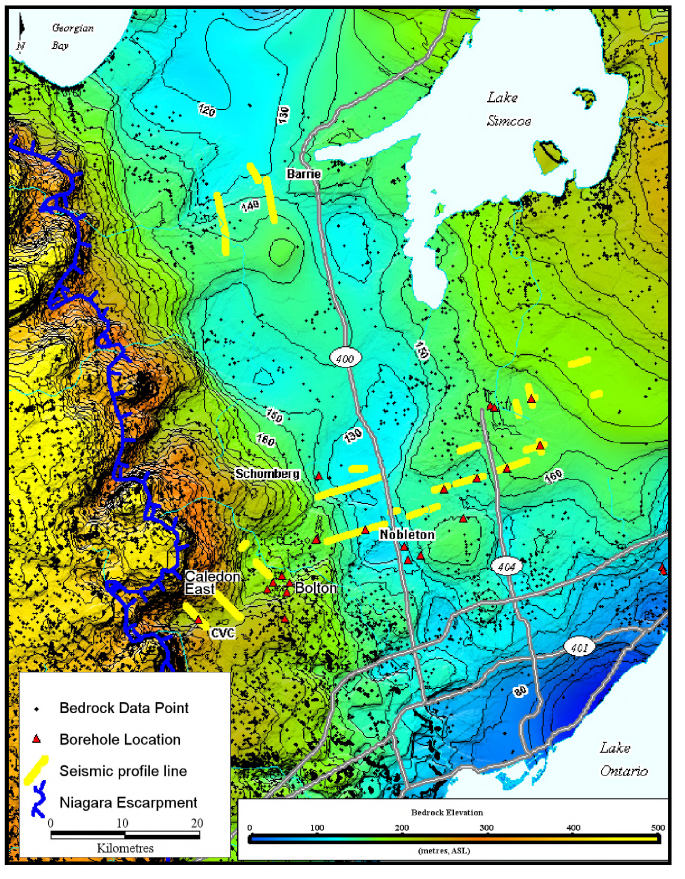
Figure 5: Interpreted regional bedrock topography. Blue shading delineates the interpreted Laurentian valley. Figure from Davies et al.2008
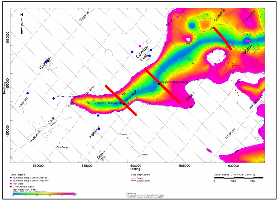
Figure 6: Interpreted local bedrock topography. Figure from Davies et al. 2008
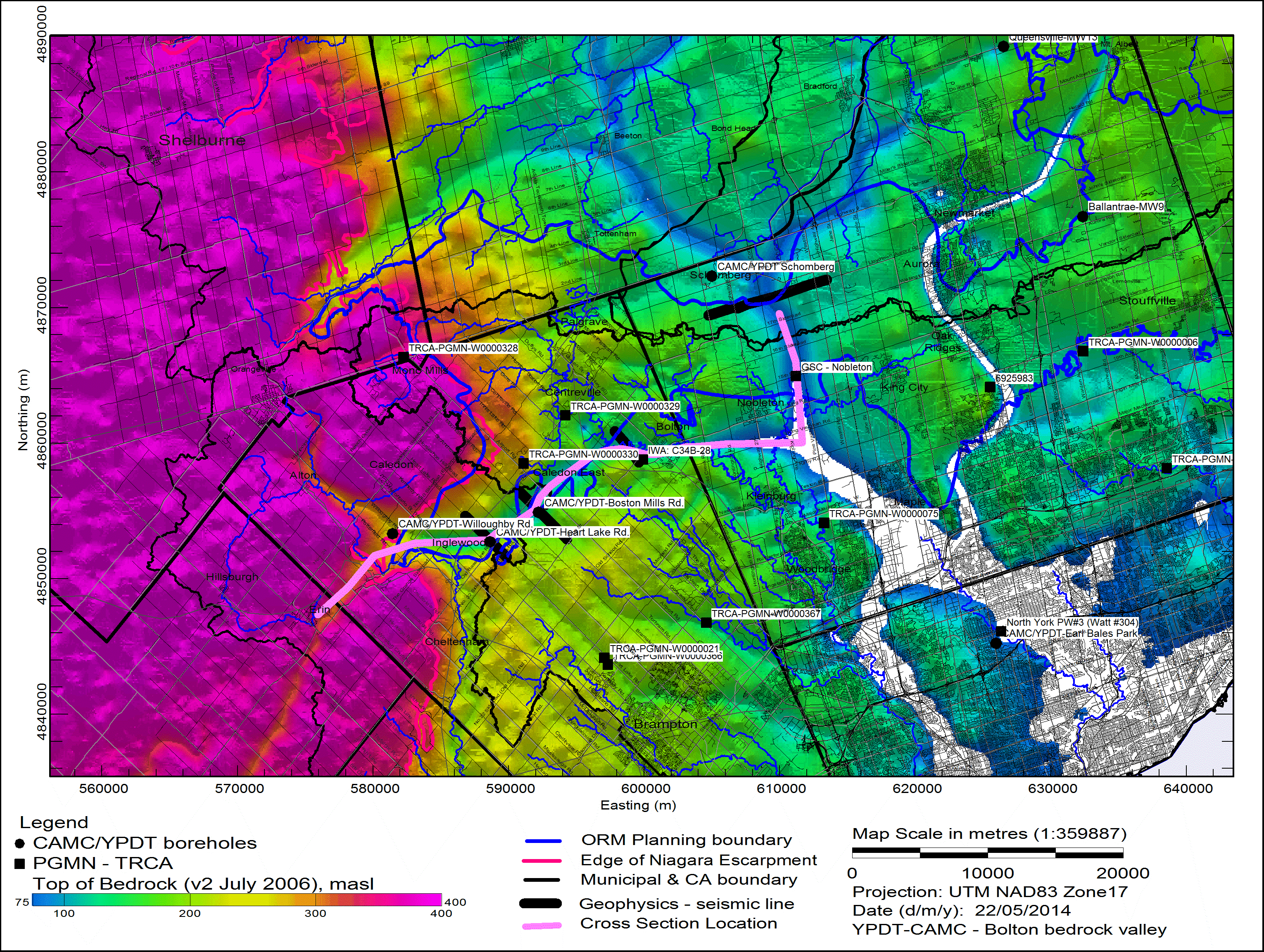
Figure 7: Cross section location along Caledon East buried bedrock valley
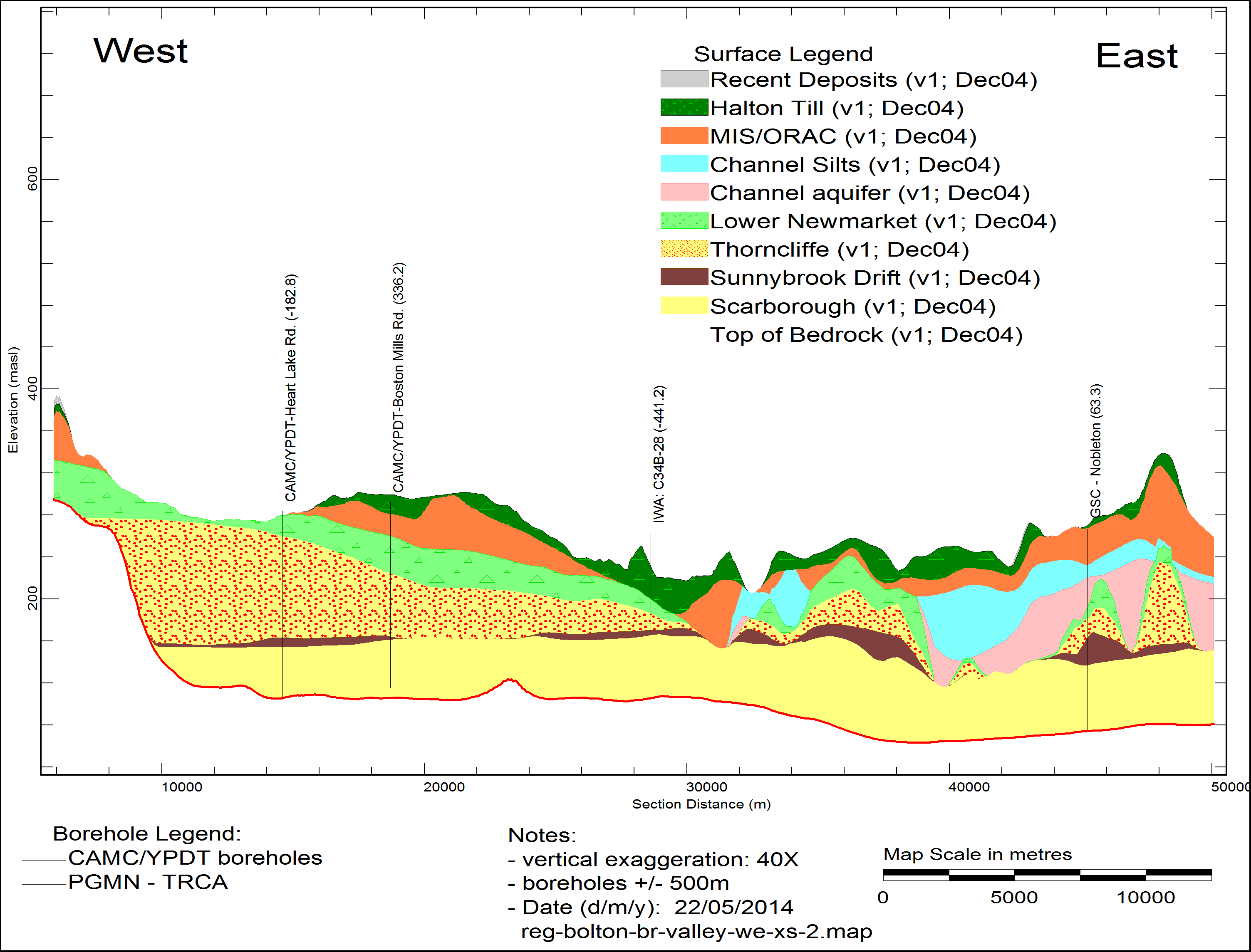
Figure 8: West-East cross section along the Caledon East buried bedrock valley showing interpreted thickness of basal channel aquifer (shown as Scarborough aquifer complex.)
1.
2.