ORMGP Subwatershed Tool Help
This document provides Help and a quick reference for the new Subwatershed Tool from ORMGP TEST
What is the Subwatershed Tool?
The ORMGP Subwatershed Tool is a mapping tool where the Oak Ridges Moraine area has been divided into subwatersheds, each covering an area of approximately 10 square kilometres.
A watershed is defined as an area of land where all water drains to a particular water body (e.g., lake, river segment). A subwatershed is a portion of a watershed where water drains to a smaller water body within the larger watershed. Each of the subwatersheds shown in this tool is located within larger subwatersheds and watersheds.
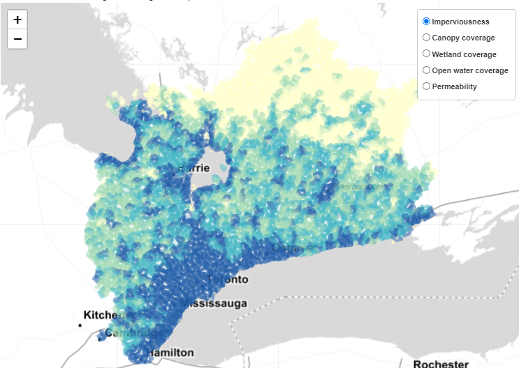
Upon opening the subwatershed tool the interactive map shows the entire ORMGP area, with discrete subwatersheds colour-coded based on percentage of impervious land cover. Using the menu in the upper-right corner, the user can select other options for the colour of the watersheds:
- Imperviousness
- Canopy coverage
- Wetland coverage
- Open water coverage
- Permeability
In Figure 1, the imperviousness is colour-coded for each subwatershed. Darker blue subwatersheds are more impervious, whereas lighter colours are more permeable.
Figure 1: ORMGP Subwatershed Tool
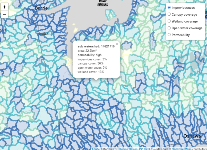
The interactive mapping tool also provides properties of each subwatershed selected by the user. When a subwatershed is selected by mouse-clicking on the map), the properties of the selected subwatershed appear in a window. These properties include:
- area of subwatershed
- permeability
- percent impervious cover
- percent canopy cover
- percent open water cover
- percent wetland cover
In Figure 2, the map is zoomed in to see the individual subwatershed boundaries in more detail. Properties of the selected subwatershed are shown in a pop-up.
Figure 2: Subwatershed Properties

