Section 2.3.7
Section 2.3.7 Report Library Information (Example)
As of version 20100915, documents in the ORMGP database are now stored as locations (LOC_TYPE_CODE of 25 - Documents) and can be treated/accessed just as any other location type. As such, document information is stored in both the D_LOCATION and D_DOCUMENT tables. Using DOC_ID 154 as an example (entitled ‘30M13-118 Highway 407 and Highway 50 Underpass’), information extracted from the document is found across a number of pages.
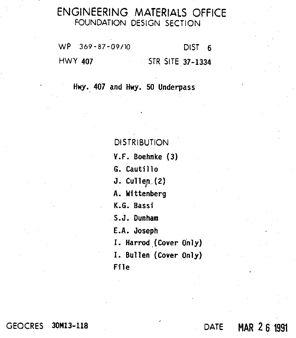 Figure 2.3.7.1 Example document - cover page
A new location would be created in D_LOCATION and the following tables populated
- LOC_NAME (154; the DOC_FOLDER_ID number, refer to Section 2.6 for details)
- LOC_NAME_ALT1 (30M13-118 Highway 407 and Highway 50 Underpass)
- LOC_TYPE_CODE (25; a document, refer to R_LOC_TYPE_CODE)
In addition, using a combination of the intersection name provided (i.e. Hwy 407 and Hwy 50 Underpass) as well as the scanned location map (below) the coordinates of the location can be determined.
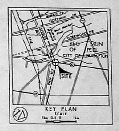 Figure 2.3.7.2 Example document - study area
- LOC_COORD_EASTING (609424)
- LOC_COORD_NORTHING (4845361)
Note that these coordinates are approximate, only, and are generally associated with the center point of the area described by the report. This is also indicated in the D_LOCATION_QA table
- QA_COORD_CONFIDENCE_CODE (5; ‘Margin of Error: 100m - 300m’, refer to R_QA_COORD_CONFIDENCE_CODE)
Note that a value of 5 or less (commonly specified as ‘<6’) is the default worst-case cut-off value used when examining locations - any value greater than six is not used. The choice of a ‘5’ value may then indicate that this location should be included in these queries.
Information for populating the D_DOCUMENT table include
- DOC_YEAR (1991)
- DOC_FOLDER_ID (154; refer to Section 2.6 for details)
- DOC_AUTHOR (Ministry Of Transportation - a GEOCRES document)
- DOC_AUTHOR_AGENCY_CODE (68; ‘MTO - Ministry of Transportation’, refer to R_DOC_AUTHOR_AGENCY_CODE)
- DOC_FORMAT_CODE (1; ‘Electronic Only’, refer to R_DOC_FORMAT_CODE; in most cases, the YPDT-CAMC group will not have a copy of the original hard-copy report, only the digital/electronic version)
- DOC_LOCATION_CODE (1; ‘Site’, refer to R_DOC_LOCATION_CODE; this report deals very specifically about a particular location, if we were dealing with a report cover, for example, the Oak Ridges Moraine, a 3/’Regional’ value would be appropriate)
- DOC_DESCRIPTION (‘1 report pdf, 1 figure’; this is a free-form text field allowing a description of the available material)
- DOC_TOPIC_CODE (76; ‘Geotechnical’, refer to R_DOC_TOPIC_CODE)
- DOC_CLIENT_AGENCY_CODE (1; ‘MOE - Ministry of the Environment’, refer to R_DOC_CLIENT_AGENCY_CODE)
- DOC_PAGE_RANGE (1-25; also a free form text field; note that in later entries, a value of 25 alone would be entered)
In addition, the report contains data that could be loaded into the database. A tag is used to both indicate its presence and whether this has been done.
- DOC_YN_LOCATION_MAP (-1; indicates a true value, there is a location map in the report; for boolean fields, any value that is not null or zero should be taken as a ‘true’ value; these fields are also referenced as a ‘checkbox’ type)
 Figure 2.3.7.3 Example document - location map
- DOC_YN_CROSS_SECTION (-1)
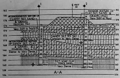 Figure 2.3.7.4 Example document - cross section
- DOC_YN_BH_LOG (-1)
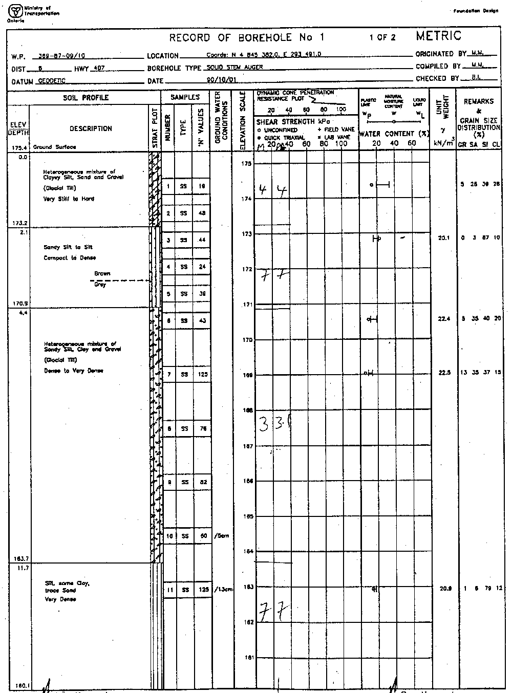 Figure 2.3.7.5 Example document - borehole log
- DOC_YN_GEOPHYSICS (0; a false value, there is no geophysics in this report)
- DOC_YN_PUMP_TEST (0)
- DOC_YN_MODELLING (0)
- DOC_YN_CHEMISTRY (0)
- DOC_YN_WATERLEVEL (-1)
- DOC_YN_DIGITAL_DATA (0)
- DOC_YN_ENTERED_BH_LOG (0; this is the first of the ‘ENTERED’ tags - in this case, at this point in time when the report was first included in the database, no borehole information was also added; it may have subsequently been entered without this field being updated)
- DOC_YN_ENTERED_GEOPHYSICS (0)
- DOC_YN_ENTERED_PUMP_TEST (0)
- DOC_YN_ENTERED_CHEMISTRY (0)
- DOC_YN_ENTERED_WATERLEVEL (0)
Note that in most reports, only that ‘YN’ and ‘ENTERED’ information pertinent to the particular report would be included and given a value of ‘0’ or ‘-1’ (i.e. false or true, respectively), the remainder would have a NULL value (i.e. no-value associated with the field).
Finally, a series of keyword fields (DOC_KEYWORD through DOC_KEYWORD10) can be used to add further information. These are also free-form text fields.
- DOC_KEYWORD (bridge)
- DOC_KEYWORD2 (underpass)
While under review, it was noted that this report contains grain size analysis as well as various Atterberg Limit Tests that would be done in a lab. As such, the DOC_YN_CHEMISTRY field should be updated (to a ‘-1’ or true value) to reflect this (refer to Section 2.3.3 concerning the use of the D_INTERVAL_TEMPORAL_1A/1B tables).
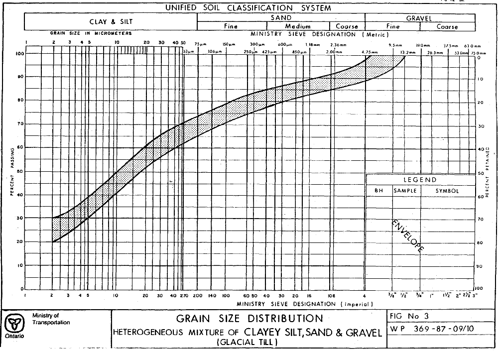 Figure 2.3.7.6 Example document - grainsize analysis