Spotflow Pickup Tool
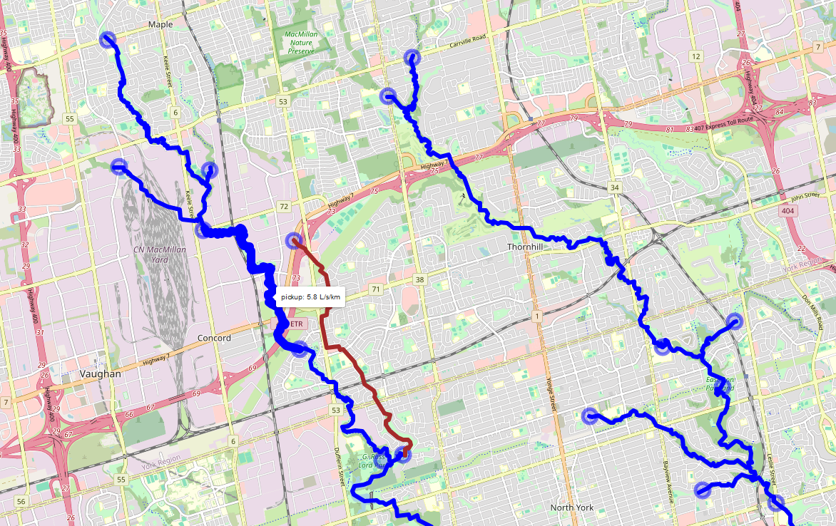
Spotflow surveys added to the ORMGP database are automatically hosted on our baseflow pickup API that translates spotflow measurements into a losing/gaining stream reach feature map. This is done by (algorithmically) coordinating surveyed spotflow locations to our watercourse topology layer. For example, any 2 spotflow measurements connected by any number of stream reaches will convert the baseflow discharges measured into a linear computation rates of gain/loss per unit kilometre of stream reach.

Screenshot of our (beta) spotflow pickup tool. Blue features represent baseflow gains, while red are losses computed between spotflow measurements (circles). Hovering over reaches/point will reveal their values.

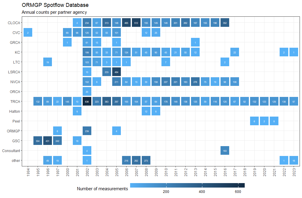
Summary of spotflow measurements shared amongst our partners.
